 submitted by Albert Gomez
miamidade.gov
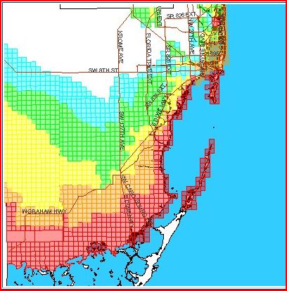
Storm Surge Planning Zones
The Miami-Dade County storm surge planning zones have been redrawn in relation to updated data which supersedes the previously-used SLOSH model. The newest generation of SLOSH model reflects major improvements, including higher resolution basin and grid data. SLOSH model grids incorporate local physical features such as geographic coastal area, bay and river shapes, water depths, bridges, etc.(Note: SLOSH – administered by NOAA - is an acronym for "Sea Lake and Overland Surge from Hurricanes.") Areas in Miami-Dade along canals and rivers and further inland have been identified as being at risk for storm surge based on this new data.
Recent Comments