SFL DRI - Emergency Management

Primary tabs

This working group is focused on discussions about emergency management.

The mission of this working group is to focus on discussions about emergency management.

Members

jperodin Kathy Gilbeaux mdmcdonald MDMcDonald_me_com

Email address for group

sfl_dri_emergency_management@m.resiliencesystem.org

'Everyone Would Have Left': Putting Lessons From Hurricane Michael To Work


A boat moved by Hurricane Michael rests near a canal in May in Mexico Beach, Fla. Seven months after the hurricane made landfall, the town is still littered with heavily damaged or destroyed homes and businesses.  Scott Olson/Getty Images

npr.org - by Greg Allen - June 7, 2019

As another hurricane season begins, emergency managers and other officials throughout the Southeast and along the Gulf Coast are applying lessons they learned last year during Hurricane Michael. Those lessons include how they conduct evacuations . . .

 . . . we're going to start seeing a lot of things change . . . 

 . . . Among those likely changes: how people prepare for storms, how many evacuate and how strong new construction on Florida's Panhandle will need to be to survive hurricanes like Michael.

(CLICK HERE - READ COMPLETE ARTICLE)


Country / Region Tags: 
Problem, Solution, SitRep, or ?: 

How Flood Control Officials Plan To Fix Area Floodplain Maps

Graphic of Texas shows the updated rainfall values in inches that define certain extreme events, such as the 100-year storm. Courtesy of NOAA

CLICK HERE - ENLARGED TEXAS MAP (1 page .PDF file)

New topographic and predictive rainfall data means more people in Harris County will be mapped in floodplains.

houstonpublicmedia.org - by Davis Land - November 26, 2018

When Hurricane Harvey left so much of Houston underwater, it highlighted a problem that’s been getting worse for years: Harris County’s existing floodplain maps just don’t work.

In the year since the historic storm, flood control officials have promised to change that, and they already had plans to redo the maps, but new data on the geography of the area and the amount of rainfall forecasters expect in the future means the new maps could look drastically different.

It’s crucial the maps are done right, as people are using the maps, meant to set flood insurance premiums, for more than they are intended . . . 

Country / Region Tags: 
Problem, Solution, SitRep, or ?: 

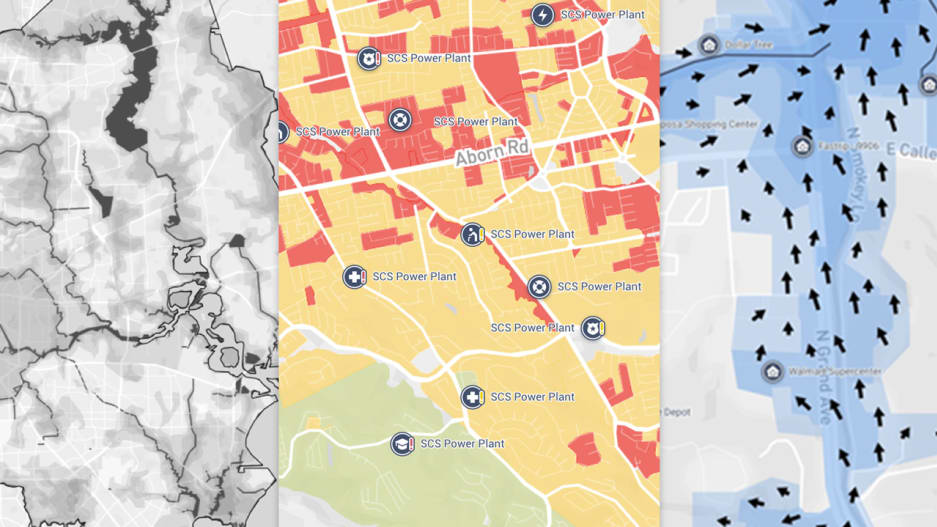
One Concern Uses AI to Streamline Disaster Relief Efforts


Image: One Concern

fastcompany.com - by Katharine Schwab - November 15, 2018

 . . . One Concern is launching a machine learning platform that provides cities with specialized maps to help emergency crews decide where to focus their efforts in a flood. The maps update in real-time based on data about where water is flowing to estimate where people need help the most. It’s the latest in a wave of AI-powered tools aimed at helping cities prepare for an era of severe, and increasingly frequent, disasters.

(CLICK HERE - READ COMPLETE ARTICLE)

---------------------------------------------------------

Our platform provides unprecedented situational awareness and actionable insights for decision-makers.

Country / Region Tags: 
Problem, Solution, SitRep, or ?: 

FEMA Flood Maps Ignore Climate Change, and Homeowners Are Paying the Price


The flood maps don’t factor in sea level rise or changes in extreme weather, and many are years out of date. In Mexico Beach, 'minimal-risk' homes were swept away.

insideclimatenews.org - by James Bruggers - November 1, 2018

The official map laid it out for more than 200 homes within the community of Mexico Beach, Florida: the federal government had characterized their flooding risks as minimal, despite their near-beachfront locations.

That meant for them there were no requirements to buy flood insurance, and local residents say many did not.

When Hurricane Michael and its 155-mile-per-hour winds slammed into the town on Oct. 10, with a storm surge of perhaps 19 feet, the result was devastation. An analysis by coastal geologists from Western Carolina University has found that 70 percent of the homes were demolished. Another 10 percent were severely damaged.

Country / Region Tags: 
Problem, Solution, SitRep, or ?: 

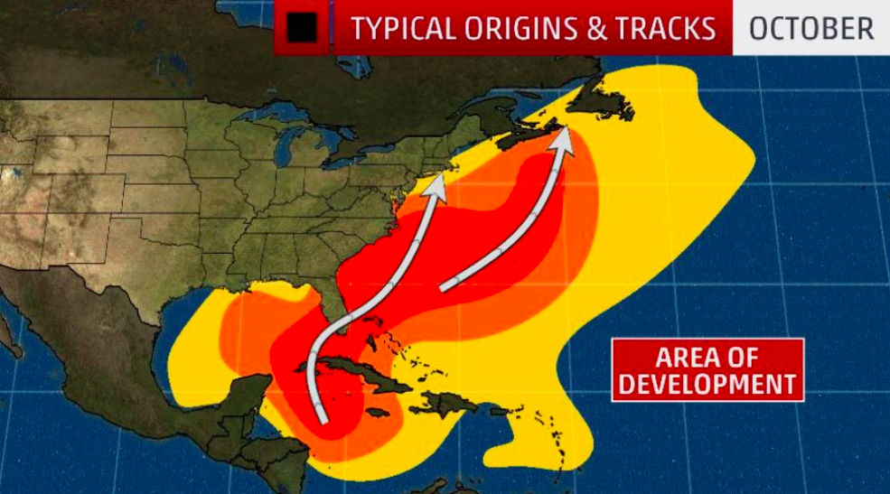
Here's Where the Greatest Hurricane Threat Is in October


These are the typical areas for development and tracks of Atlantic Basin tropical cyclones in October.

weather.com - by Linda Lam and Brian Donegan - September 27, 2018

At a Glance

Florida is the state most likely to see a landfalling hurricane in October.

Since 1950, 15 hurricanes have made a U.S. landfall in October, eight of which occurred in Florida.

In South Florida, October is the month with the most hurricane direct hits.

(CLICK HERE - READ COMPLETE ARTICLE)


Country / Region Tags: 
Problem, Solution, SitRep, or ?: 

National Hurricane Center - Tropical Cyclone Status Updates

Country / Region Tags: 
Problem, Solution, SitRep, or ?: 

Miami Beach - Storm Surge Warning

Via City of Miami Beach: Miami Beach is under a storm surge warning. Please stay indoors and avoid driving if possible!

Country / Region Tags: 
Problem, Solution, SitRep, or ?: 

'Weather models have flipped the switch': Hurricane season coming to life in the Atlantic


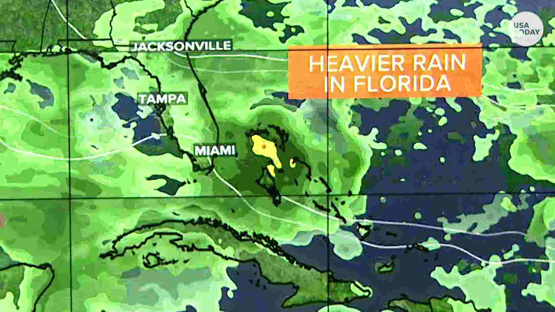
As hurricane activity starts to ramp up, Meteorologist Bobby Deskins is tracking a wave in the Windward Islands that's expected to bring heavy rain to the Southeast early next week. USA TODAY

usatoday.com - by Doyle Rice - August 29, 2018

The sleeping giant may be about to awaken.

Hurricane activity in the Atlantic Ocean, Caribbean Sea and Gulf of Mexico is forecast to ramp up over the next couple of weeks. "Weather models have flipped the switch on the Atlantic hurricane season and see multiple areas of development possible, starting mainly this weekend," weather.us meteorologist Ryan Maue said.

(CLICK HERE - READ COMPLETE ARTICLE)


Country / Region Tags: 
Problem, Solution, SitRep, or ?: 

Resilience Hubs White Paper - Shifting Power to Communities and Increasing Community Capacity

CLICK HERE - Resilience Hubs White Paper - Shifting Power to Communities and Increasing Community Capacity (10 page .PDF document)

usdn.org

Summary

Resilience Hubs are community-serving facilities augmented to:

1.  support residents and

2.  coordinate resource distribution and services before, during, or after a natural hazard event.

They leverage established, trusted, and community-managed facilities that are used year-round as neighborhood centers for community-building activities. Designed well, Resilience Hubs can equitably enhance community resilience while reducing GHG emissions and improving local quality of life. They are a smart local investment with the potential to reduce burden on local emergency response teams, improve access to health improvement initiatives, foster greater community cohesion, and increase the effectiveness of community-centered institutions and programs.

(CLICK HERE - READ COMPLETE ARTICLE)

Country / Region Tags: 
Problem, Solution, SitRep, or ?: 

Pages

howdy folks
Page loaded in 0.761 seconds.