submitted by Jan Booher

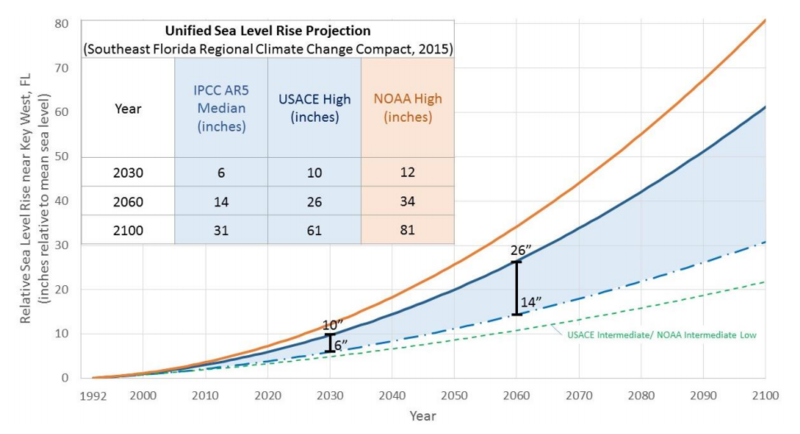
Figure 1: Unified Sea Level Rise Projection. These projections are referenced to mean sea level at the Key West tide gauge. The projection includes three global curves adapted for regional application: the median of the IPCC AR5 RCP8.5 scenario as the lowest boundary (blue dashed curve), the USACE High curve as the upper boundary for the short term for use until 2060 (solid blue line), and the NOAA High curve as the uppermost boundary for medium and long term use (orange solid curve). The incorporated table lists the projection values at years 2030, 2060 and 2100. The USACE Intermediate or NOAA Intermediate Low curve is displayed on the figure for reference (green dashed curve). This scenario would require significant reductions in greenhouse gas emissions in order to be plausible and does not reflect current emissions trends.
southeastfloridaclimatecompact.org - Prepared by the Sea Level Rise Work Group - October 2015
Problem, Solution, SitRep, or ?:
Recent Comments